
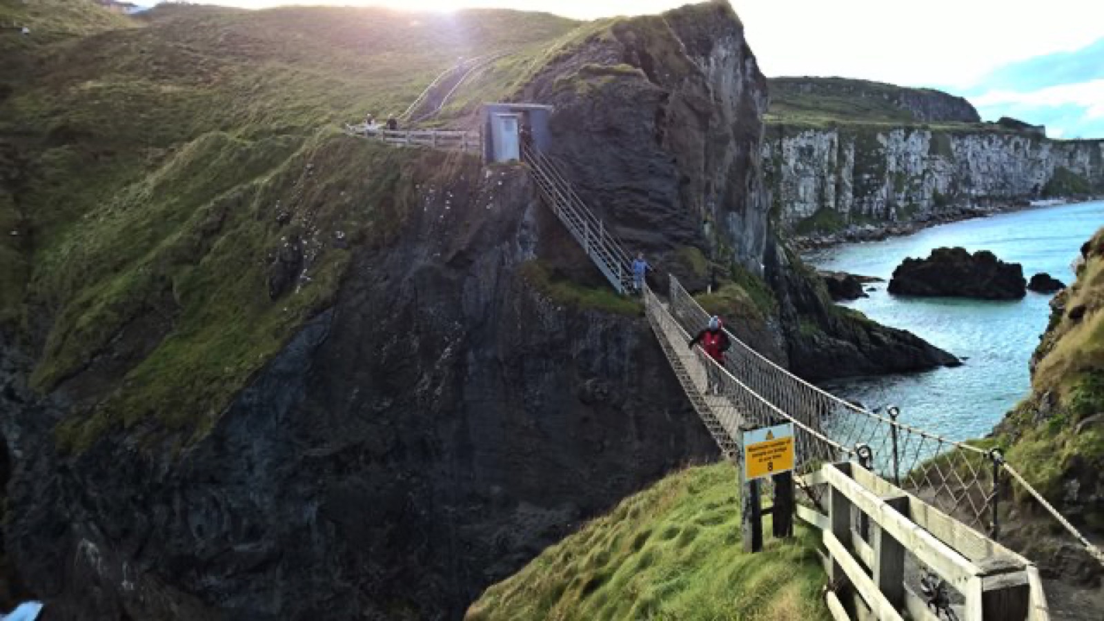
Located around 8 miles from the Giant’s Causeway along the Causeway Coast, close to Ballintoy, Carrick-a-Rede Rope Bridge is a suspension bridge linking Carrick Island to the mainland — a 20-metre span, 30 metres above the Atlantic, maintained by the National Trust. Nearly half a million people cross it each year.
History
The name “Carrick-a-Rede” means “rock in the road,” and salmon fishermen are believed to have built bridges to the island for more than 350 years. Over the years, the bridge has taken many forms — in the 1970s, it had significant gaps between the slats and only one handrail. In 2000, local climbers built a version tested to hold ten tonnes; a new design followed in 2004 for safer passage. The current wire rope bridge with a Douglas fir walkway was built in early 2008 by Belfast’s Heyn Construction, at a cost of more than £16,000. There’s no record of anyone falling off — though there have been cases of visitors unable to face walking back across, needing a boat off the island instead.
Fishing
The island isn’t used during the salmon season (June–September) by fishermen any more, since so few salmon remain — around 300 fish were caught each day in the 1960s, but by 2002 only 300 were caught across the whole season. The salmon still return each year to spawn in the River Bush, near Bushmills, and the River Bann at Portstewart.
Features
The area has exceptional natural beauty, with views of Scotland and Rathlin Island, and has been declared an Area of Special Scientific Interest for its fauna, flora, and geology. A car park sits at the base of Larrybane Head, once home to a peninsula fort over 1,000 years old — since quarried away, leaving a stark quarry face full of fossils and flint. Large caves beneath the quarry once sheltered fishing vessels in storms and served as a boat builder’s yard. The clifftop walk is genuinely exhilarating even before you reach the bridge — the sea shifts through every shade of blue and green in summer.
The bridge itself was originally built by fishermen at a summer salmon fishing station; their whitewashed cottage, with its wooden stairway and winch, still sits in the island’s only sheltered spot. Every step moves the bridge slightly, even on a calm day, and its 20-metre length feels considerably longer when you’re on it. Nearly 500,000 visitors cross each year, with only a single inch-thick board separating you from the rocks and waves 30 metres below — but the island itself is a genuinely isolated, undisturbed spot, home to nesting razorbills, guillemots, and fulmars.
Geology
Carrick-a-Rede Island is one of the best examples of a volcanic plug in Ireland or the UK — erosion by the Sea of Moyle has exposed the neck of an old volcano. The violence of molten rock punching through soft limestone around 60 million years ago is visible today in explosion breccias, tuff, grey volcanic ash, and explosion bombs in the island’s rock layers.
The characteristic Ulster Chalk, topped by basalt cliffs, runs along the North Antrim coast, forming much of the Antrim Plateau. At Carrick-a-Rede, the ancient volcanic pipe deposited dolerite — tougher than basalt, and slower to erode. Behind it, the vent filled with pyroclastic rock that weathers far more easily into a coarse tuff agglomerate. The island as it stands today is the product of that harder rock out front and softer rock behind, shaped by the sea over millions of years.
Getting there
Carrick-a-Rede is around 20 minutes (15 miles) from Portrush, and about an hour (60 miles) from Belfast. Opening hours vary by season — check the National Trust’s official page before you travel, since hours and ticket sale cut-offs change with daylight and demand.